Showing posts with label America. Show all posts

20221010

Facts about Mysterious Easter Island Chile

The Mysteries of Easter Island


      Although this island is remote and requires extra effort to visit it, your fatigue will pay off when you are here.
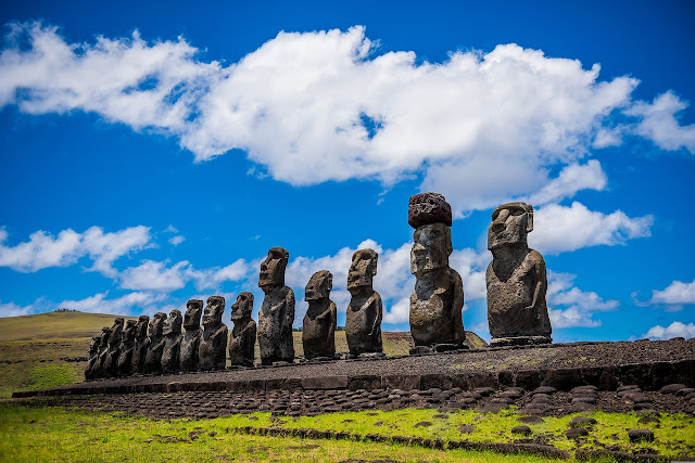
On Easter Island, you can see nearly 900 primitive sculptures carved by early Polynesians. These statues called moai were carved about 1,000 years ago, and seeing them in person is an experience of a lifetime that you will never forget. Even so, there are many interesting facts about Easter Island.

Easter Island Chile

According to the index from the United Nations (UN), Easter Island is the most isolated inhabited island in the world.
Easter Island It is located in the southeast of the Pacific Ocean, and the nearest country to this island is Chile. Easter Island has been in Chile since 1888.

Origin of The Name Easter Island

A Dutch admiral, Jacob Roggeveen, is said to be the first European to land on Easter Island on Easter Sunday in 1722.
According to the time of his arrival, Roggeveen gave the name of the island as Paasch-Eyland, which in Dutch, means Easter Island.

Besides being known as Easter Island, this area has another name, namely Rapa Nui, which is still used by the local population. However, whether the name is the original name of this island is still a debate. Others believe that the name Rapa Nui was given by slave robbers from Peru in the mid-19th century. Previously, this island was believed to have the first name Pito O Te Henua or navel of the world.

Mysterious Easter Island Chile
                                                          Image Source: wikimedia.org

Easter Island Civilization

According to history, recorded the arrival of Hotu Matu'a in the 1200s and Jacob Roggeveen 500 years later, making the population on Easter Island grow.
It is known that there were around 10,000 people who settled over the years. However, the population decreased to around 2,000-3,000 people. This is due to deforestation and the erosion of volcanic soils, resulting in decreased fertility.

The population also continued to decline following the arrival of Europeans. Dissension between social groups causes housing to be burned, leading to starvation and the emergence of homelessness.
In addition, there were raids by Peruvian slave traders, plagues, and emigration, so that by 1877 only 111 people were left on Easter Island.
In 2020, quoted from CNBC, it was recorded that there were around 5,700 residents on this island.

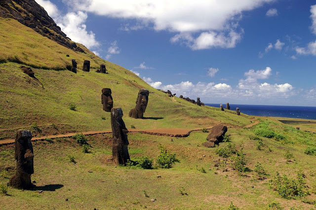
Easter Island Moai

Moai at Easter Island

The basic material for the statues or moai on Easter Island is tuff or volcanic ash that is compacted. This ash can be found in the crater area of Rano Raraku volcano on the island.
As a soft rock, tuff can easily be shaped by hand or chiseled stone, the finished sculpture was then carried from the crater area to around Easter Island, but unfortunately the story of this creation is based solely on oral information that has been passed down from generation to generation.
Until now there have been no concrete clues as to how the statues on Easter Island were transported, as many of the statues were partially buried, and the heaviest was 82 ton.

The Meaning of Moai

The inhabitants of Easter Island carved the huge stone statue to represent the face of their ancestors.
The reason why the statues were facing inward was to show protection for each other. Some moai have the shape of a hat on the head, which is a symbol of power, and others represent hair.
Initially, there were thousands of statues of moai, but before the island was made a UNESCO World Heritage Site in 1995, many of the statues were taken by collectors. Moai themselves can also be found in a number of museums around the world, the most famous of which are the Louvre in Paris, France, and the British Museum in London, England.

How to Go to Easter Island

For travelers who want to visit Easter Island, the only way is to take a plane, because there is no port in this place.
The island has a small airport called Mataveri, and there is only one airline that serves flights to the island, namely LATAM.
Mataveri Airport was built by NASA as a shuttle emergency line. The shortest flight duration to Easter Island is around five hours via Santiago Airport in Chile. Meanwhile, if you fly from Tahiti in French Polynesia, the duration is around seven hours.

20220930

Reasons Travelers Visit The Amazon Forest

Reasons That Make You Want to Visit the Amazon Forest 


     The Amazon is the world's largest rainforest. The area of the Amazon basin itself reaches 7.7 million square kilometers, meanwhile, the Amazon river is the largest river in the world. So you can imagine how big the Amazon jungle is. The Amazon River was named by a Spanish soldier named Francisco de Orellana in 1541. He was also one of the first to explore the Amazon river.

Amazon forest America
                                                            Image Source: wikimedia.org

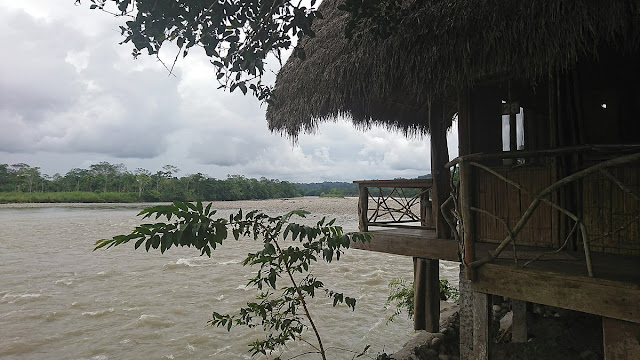
You should never think that the Amazon jungle is unvisited. The Amazon does consist of forests and rivers. However, the Amazon has become one of the most visited tourist destinations by travelers. So, there are already a lot of lodges standing on high ground in the Amazon jungle.
The Amazon divides the territory of nine countries in the Latin American region, and has attracted tourists to enjoy the beauty of the unique flora and fauna, as well as interact with the indigenous Amazonians. What are some of the features of Amazon that make you want to go there?

The Amazon Forest is a Natural Wonder of the World

In 2011, the Amazon forest was declared the New 7 Wonders of Nature. 
The Amazon region itself consists of an area of tropical rain forest that reaches 5.5 million which is drained by 6,992 kilometers of rivers.
The Amazon forest holds an extremely rich biodiversity. Therefore, the Amazon rainforest is referred to as the lungs of the world.
Amazon river is the eighth oldest river in the world. The flow of this river was formed 200 million years ago.

See the Typical Animals of the Amazon

Have you heard of any typical animal that lives in the Amazon jungle? Maybe you know about the anaconda snake and the piranha fish. When you visit the Amazon, you can also find animals such as woodpecker birds, squirrel monkeys, to pink dolphins.
In addition, according to the natives there, the animals that live day and night in the Amazon are definitely different.

Amazon Forest Lodge
                                                                 Lodge in Amazon

Staying in a Lodge in the Middle of the Amazon Forest

The Amazon is made up of forests and rivers. Amazon is also one of the tourist destinations visited by many tourists. So, there are already many lodges that stand on high ground in the Amazon jungle.
What about facilities? Of course, there is no electricity, internet connection and telephone connection. Only basic facilities such as bed and mosquito net (because there are a lot of mosquitoes) and bathroom are available there.
What about the food? Every chef at the lodge is used to serving delicious food prepared from ingredients that are easily found on Amazon.

The Amazon forest is the lungs of the world, capable of producing 30% of all oxygen on Earth. This forest contains rich biodiversity. 30% of all animals and half of all plant species that exist on earth live in the Amazon forest

Native Amazon People
                                                    Image Source: intelligentliving.co

Meet Native Amazonians

The Amazon has about one million indigenous people who are divided into 400 tribes. Some of them have had contact with the outside world since 500 years ago, while others have not.
The Yagua tribe is one of the tribes who inhabit the Amazon jungle in the Peruvian region, and has been in contact with the outside world. Adult Yagua men only wear skirts made of thatch, while women only cover the lower body with red cloth. Meanwhile, the little ones are wearing nothing.
However, there are also native Amazonians who have worn clothes. Residents in San Juan de Huashalado are familiar with the school, it has a field and meetinghouse, and also a church.

When is the best time to visit Amazon Forest?

The best time to visit the Amazon is during the dry season (July – December), when the water level is low, and hiking trails are suitable for travelers. However, during the rainy season (January – June), the weather in the Amazon jungle is mild, and there are greater opportunities to see the animals.

20220912

Torres del Paine, Stunning National Park in Chile

Vacation to Chilean Patagonia is a Must!


      Chile is one of the regions known for its beautiful natural attractions, with its diverse flora and fauna.
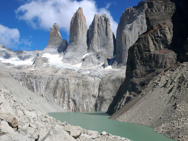
One of the most popular tourist attractions in Chile is Torres del Paine National Park (Spanish: Parque Nacional Torres del Paine).

Torres del Paine
                                                       Image Source: wikimedia.org

Torres del Paine National Park is located in the Magallanes region, just north of Puerto Natales and Punta Arenas.
The two regions are quite important in Chile because they border the O'Higgins National Park and Los Glaciares National Park.

The park is visited by an average of 252,000 visitors per year, 54% of whom are foreign tourists. which come from many countries around the world. It is also part of the End of the World Route, the tourist scenic route.

The park is one of 11 protected areas in Chile's Magallanes Region and Antarctica (along with four national parks, three national reserves and three national monuments). Together, the protected forest area covers approximately 51% of the total area (6,728,744 hectares).

Despite being situated in a fairly remote location, Torres del Paine is the largest and most visited park by tourists in Chile.
This National Park offers a very amazing natural scenery. This top tourist spot in South America also has glaciers, rivers, forests, and meadows, making it a hidden paradise for nature lovers. Torres del Paine National Park is also home to an endangered deer species.

Established in 1959, the name Torres del Paine has been given since 1970 for this national park.
Torres Del Paine National Park has been visited by many world famous scientists, climbers and explorers.

UNESCO included Torres Del Paine National Park in Chile as a World Biosphere Reserve in 1978.
Unlike the Royal Botanical Gardens, which tend to be safe, a trip to the 181,414 hectare Torres del Paine National Park is the exact opposite.

This park in Chile will take you on an adventure and meet the diverse flora and fauna of the forest in their natural state.
To get to Torres del Paine National Park, there are three entrances, namely Rio Serrano, Lago Sarmiento, and Laguna Armaga which can be accessed from different locations.

Grey Parque Nacional Torres Del Paine

If you want to use public transportation or take a tour, there are various options with predetermined rates and fees.
To get to the national park there is a bus from Puerto Natales, a bus from Punta Arenas, a bus back to Puerto Natales and tours with travel agents.

The park has experienced three major man-made forest fires since 1985, destroying a forest of Lenga trees that took at least a century to fully recover.

History of Torres del Paine

Mrs Florence Dixie, in her book published in 1880, gave the first description of the area, and referred to the three towers as the Needles of Cleopatra. Mrs Florence and her party are credited with being the first "foreign tourists" to visit the area now called Torres del Paine National Park.

Several European explorers and scientists visited the area in the following decades: Carl Skottsberg, Otto Nordenskiöld, and Alberto María de Agostini. The first person to fly over the Paine massif was Gunther Plüschow

The park was founded on May 13, 1959 as Parque Nacional de Turismo Lago Grey, and was given its name in 1970.
In 1976, British mountaineer John Garner and two Torres del Paine rangers, Pepe Alarcon and Oscar Guineo, spearheaded the Circuit trail that surrounds the Paine massif.
In 1977, Guido Monzino donated 12,000 hectares (30,000 acres) to the Chilean Government when the definitive limits were set.

20220829

The Legend of Iguazu Falls You Didn't Know

Iguazu Falls, Niagara Falls Rivals on the Border of Brazil and Argentina


      This world has many amazing tourist attractions to visit. There are a lot of amazing waterfalls in the world. Some of them are towering, there are also waterfalls so large that they look like giant walls.

Iguazu falls Argentina
                                                             Image Source: wikimedia.org

The Iguazu Falls are one of the best places to visit in South America, Iguazu is the largest waterfall system in the world, with 275 waterfalls of various sizes and Devil's Throat is the largest. The iguazu falls are located 10.5 miles from the Iguazu River, where the borders of Argentina, Brazil and Paraguay meet. This waterfall is perfect for you who like natural attractions.

The Legend of Iguazu Falls

Iguazu Falls is taken from the word in the Guarani language which means large water. It is said that a god wanted to marry a woman named Naipí. Unfortunately, Naipí doesn't love him and instead runs away with his eternal lover, Tarobá, by canoe. When he saw this incident, the gods became angry and split the river, so that a waterfall was created, and cursed them both to be in the river forever.

It is also said that there is a huge snake called Boi living in this Iguazu river. To appease the viciousness of these snakes, the aboriginal tribes sacrificed a woman every year. One day, the natives of the Guarani kidnapped the woman who was to be sacrificed and rescued her from a traditional ritual. They were running through the river, and when Boi found out, he was furious. Then, the big snake bent its body, and divided the river to separate the male and female.
Fact: Iguazu Falls was formed due to a very large volcanic eruption, leaving a huge gap.

The landscape of Iguazu Falls is an attraction in itself for tourists. As far as the eye can see, there are rows of stunning waterfalls, some of them big and strong, some are smaller. Being next to Iguazu Falls, the humans looked so small.
This is because the size of the waterfall has an area of 2.7 kilometers. Iguazu Falls consists of a combined approximately 275 waterfalls. This number depends on the season. The tallest waterfall in Iguazu Falls is called Devil's Throat.

This waterfall is about 80 meters high. The stream descends into a white abyss, with permanent waterdrop fog clouds. During the rainy season, Iguazu Falls is higher than Niagara Falls. The height of this waterfall is rivaled only by Victoria Falls in Zambia and Zimbabwe with a height of approximately 108 meters.

Iguaçu Falls

Iguazu Falls are also wider than Niagara Falls and Victoria Falls. The amount of water flowing in this waterfall is so large, around 1,500 cubic meters per second. When it's heavy (usually November-March), the water flow can reach 13,000 cubic meters per second.

Iguazu Falls is located in the middle of a rainforest in the interior of South America. The preservation of the forest is really guarded by the governments of Brazil and Argentina. The area around the waterfall is teeming with wildlife. This forest is home to more than 2,000 species of plants, about 400 species of birds, 800 species of mammals, countless insects and invertebrate species.

Iguazu Falls has also officially become a part of the UNESCO World Heritage Site in 1984 ago. This waterfall also won the award again in 2011 when it won the New Seven Wonders of Nature competition.

20220723

Test Your Guts In Pacific Rim National Park

The Most Beautiful National Parks in Canada 


      Do you want to travel as well as adventure to test your guts? You have to come to Pacific Rim National Park, which is at the western tip of Vancouver Island, British Columbia, Canada.
Canada has become an idol place for many foreign tourists who want to enjoy the conditions and fantastic natural scenery. This country, which is located on the north side of the American continent, is known to have enchanting National Parks that are spread across several provinces in Canada.

Pacific Rim National Park
                                                            Image Source: Wikimedia.org

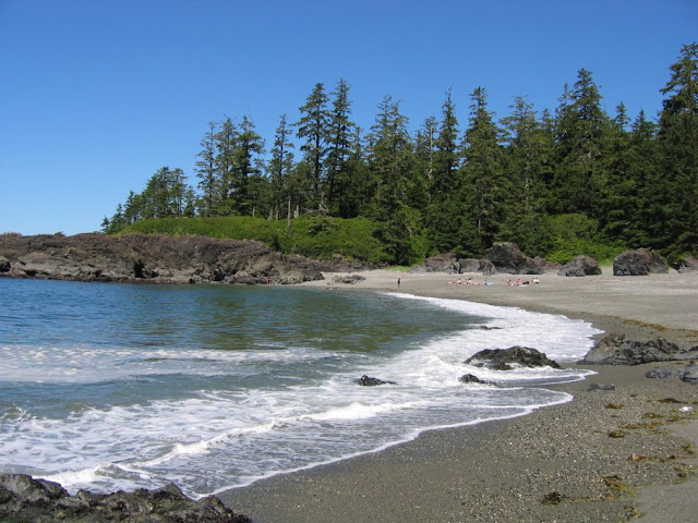
Pacific Rim National Park is a national park with an area of about 13,000 hectares consisting of 7000 hectares of land in the form of land, and 6000 hectares of water areas. Based on the types of tourism available, the attractions in this national park are divided into three parts: the Broken Island area, the West Coast Trail, and the Long Beach area.

Pacific Rim National Park Reserve sells lush forest conditions, which are close to the coastal location. The rainy weather that continues to water this area makes the trees and plants that live in this National Park look very fertile and green.
Pacific Rim National Park Reserve has one of the most legendary and challenging hiking trails where you can go through a 75 km hiking trail.

This place has a native tribe who still adheres to local customs, the name is Nuu-chah-nulth. The indigenous people who are also called the Nootka or Nutka tribes are known as primitive oceanographers as well as excellent whalers.

In ancient times, the Nutka tribe fought sailors from Spain, England and America who wanted to exploit the mines under the Pacific Ocean. But now, they can live in harmony with the Canadian government, even some of the younger generations of the Nutka tribe are on the administrative and interpreting staff of the Pacific Rim National Park program.

West Coast Trail Canada

To enter the Pacific Rim National Park area, you will not be charged with a special ticket. However, if you bring a vehicle, you will be charged a parking fee. To get to this national park, you can take a ferry from West Vancouver, Horseshoe bay to Nanaimo then head to Tofino.

For those of you who prefer to explore water, the Broken Island area is the ideal choice for you to choose. Here, you can sail, take a boat, fish, scuba dive, and go kayaking. Broken Island is only accessible by boat because it consists of 100 islands that are separated from each other.

Meanwhile in the West Coast Trail area, you can enjoy how exciting it is to climb hills, camp in the wild, backpacking, and see the view of this national park from a height. This area is very suitable for those of you who like adventure.

Long Beach provides beach tourism objects. Long Beach is one of Canada's most popular coastal destinations. It is located in Pacific Rim National Park, British Columbia, Canada. This beach is also the widest beach in the Pacific Rim nature reserve area.  In this area you can do a variety of interesting activities such as surfing, beach combing, camping, swimming, hiking, snorkeling, kayaking, and many other activities.

20220718

Exploring the Marble Caves in Chile Patagonia

Cuevas de Marmol, Most Beautiful Marble Cave in Chile


      Cuevas de Marmol or Marble Cave is a tourist destination in the form of a unique cave with exotic beauty in Lake Carrera, Patagonia, Chile. Cuevas de Marmol can be hard to remember, so locals simplify it to Marble Caves. This cave is very pretty and made of marble.

Marble Caves Chile
                                                         Image Source: Wikimedia.org

This marble cave will make you feel like a little mermaid like Ariel. The beauty of the dazzling colors and the pure water makes you want to hum the song Under the Sea, the soundtrack of the film The Little Mermaid.

The cave famous as Ceuvas de Mármol is located in the Patagonian Andes. This unique geological formation lies in the waters belonging to Argentina and Chile. Access to get there is only possible by boat.
When it was formed more than 6000 years ago, where the lake currents touched the marble, slowing down its formation and making the texture as smooth as it is now.

Although the marble itself is not a brilliant blue, it looks beautiful with a sky blue appearance when the water reflects off its light. As a result, colors change throughout the year, depending on the water level and the season.

To get Marble caves you need to take a 2.5 hour flight from Santiago, Chile to the City of Balmaceda. Then you'll have to travel a few more hours through caves that are winding, hilly and 120 miles away.
Eventually you'll reach General Carrera Lake, where you can hop on a ferry and sail for 30 minutes to reach this gorgeous marble cave.

History of Cuevas de Marmol

This Marble Cave was formed as a result of sea water erosion that occurred 6,000 years ago. Erosion of seawater that has eroded the cave walls over the years makes this cave wall look like a painting with a variety of colors, such as blue, green, turquoise, and others.

Because it is on the border, this peninsula also gives birth to a beautiful work of art beneath. Through a long process, some 6,000 years, the cave was eroded by waves, currents and natural tides.
The peninsula's walls began to take the form of a cave. the tides of the ocean made a trail on the cave walls.
The changing water level makes the carvings on the cave walls change with time and season. Reflecting light that refracts from the seawater makes the cave walls blue.

The main attraction of this cave is the color of the cave walls that can change depending on the water level and the season.
The best time to visit this cave is between September and February when the ice melts and the water changes to a turquoise color.

20220712

Naica Mine Mexico, Stores Giant Crystals Cave

 Naica Mine, a Mine in Mexico That Looks Like from Another World


      Have you ever heard of a cave filled with crystals like in a fairy tale movie? This cave filled with sparkling crystals is a real thing. This cave is in Naica Mine.

Naica Mine is actually the name of a crystal mining location located in Chihuahua, the state of Mexico, to be precise in Naica, Saucillo city. There are several ores in Naica, namely, lead (Pb), zinc (Zn), and silver (Ag). All of these mines are operated by Industrias Penoles, which is the largest lead producer in Mexico.

Naica Mine Mexico

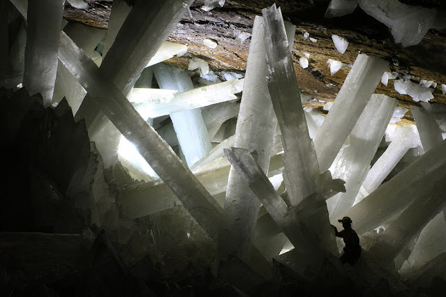
Deep beneath the depths of the mine are hidden caves that are renowned for their crystal beauty, like a cave that holds treasure. This cave is filled with hundreds of giant crystals 12 meters high.

Naica Mine has become a very special tourist destination. The country where Naica Mine is located also has many beautiful natural landscapes.
The Crystal Cave is known as the "Cueva de los Cristales". There were dozens of giant white and purple crystals, which at first glance looked like broken glass. The amazing formation makes this place feel like a place on an alien planet.

This cave produces crystals with a super large size, so it makes you who enter the cave feel like covered in water. These crystals are among the largest crystals in the world. The largest crystal ever found there is 12 meters long, 4 meters in diameter, and weighs up to 55 tons. That's why this cave is also known as the Cave of the Giant Crystals. (jpl.nasa.gov)

The crystal found in the cave under the Naica mine was a type of selenite crystal or gypsum 1.2 m (4 ft) in diameter and up to 15 m in length. It is the largest selenite crystal ever discovered.

Early Discovery of Crystal Cave at Naica Mine

This crystal cave is located 300m below the surface of Naica. It was first discovered during the mining process. At that time, the miners who were mining in the mining area had just discovered the crystal cave. After the discovery, the cave was closed to the public, and became really very closed off after the workers attempted to enter the cave to steal some of the crystals contained in the cave.

However, when they entered the cave to collect crystals, they actually lost their lives due to suffocation due to the conditions and atmosphere of the cave which were very unfriendly.

Naica Mine stands on faults or fractures in the earth that were formed in the past. Under the crystal caverns there is a magma pocket that heats the water, so it contains a lot of minerals, one of which is gypsum. The high mineral content of water there is maintained at a temperature of 50 degrees Celsius for approximately 500,000 years.

This phenomenon is what causes the crystal chunks there can be very large. But because the temperature is very high, it can reach 58 degrees Celsius with a humidity of about 99%, these caves are quite difficult to explore, let alone become a tourist spot. Because, without adequate protection, you can only survive in the cave for no more than ten minutes.

Gypsum Naica Mine Mexico

These crystals look like glistening ice that is very cold, but the temperature in this cave is actually very hot, it can reach 60 degrees Celsius with a humidity level of 90-100%. Almost no strong human being there for long.

Tourists still have access to enter this cave, only the number is limited.
Because the temperature in the cave is very hot, tourists who enter this cave must use special clothes. Cave explorers must wear protective suits, protective helmets complete with head lamps, and packs of ice. It took them 20 minutes for these cave explorers to arrive at the entrance of the Cave of the Crystals.

20220624

Blue Lagoon Galapagos Island Ecuador

The Blue Lagoon Ecuador, Unique Hot Springs in the Middle of the Ocean


      Who doesn't like soaking in hot water? The warm water temperature when it touches our skin is very comfortable and unforgettable. Its relaxing effect that can make fatigue disappear is one of the reasons why many people choose to install water heaters in their homes.

Blue Lagoon Galapagos

A hot spring in the middle of the sea may sound strange to some, but it turns out that it exists in the world. Generally we often find hot springs in certain natural or artificial places on land. However, this is different from The Blue Lagoon Ecuador where a hot spring bath is located in the middle of the sea.

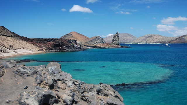
Located in Rocas Baimbridgen, there are hot springs in the middle of the ocean. The baths, known as The Blue Lagoon, are part of the Galapagos island of Ecuador. When viewed from a height, this hot spring is located in the middle of the sea and looks somewhat blended with sea water.
The hot water is part of the lava formation, the formation of this hot water is because the place is a former volcano that is no longer active. This dormant volcano once exploded and formed a very large crater. Now the crater is filled with warm water heated by geothermal energy.

Most of the islands of the Galapagos are isolated, devoid of human life. The number of people allowed into the Galapagos National Park per year is limited, and they must travel to the protected area with a licensed guide. (huffpost.com)

Blue Lagoon Galapagos is located in Ecuador. The wild animals in this place are very docile and are not afraid of humans at all.
This place is favored by a large number of wild animals, such as flamengo birds and sea lions. Information on tourist attractions that you must know and you should visit information sites that you know and rigid mandatory.

How did The Blue Lagoon form? This hot spring was once a former volcano that was dead and not active anymore. The crater where the hot springs were formed was born from a volcanic eruption, creating an eruption. The water inside becomes hot because it is affected by the effects of the formation of lava in it plus geothermal heat.

Blue Lagoon Galapagos Island Ecuador

Water temperatures in the bathing and swimming areas of the lagoon average 37-39 °C (98-102 °F). Blue Lagoon Ecuador also operates a Research and Development facility to help find cures for other skin ailments using mineral-rich water. But unlike most hot springs on land, the Blue Lagoon Ecuador is located in the middle of the ocean.

Currently, The Blue Lagoon has become a tourist spot as well as a place of research because of its uniqueness. Not much different from hot springs in general, The Blue Lagoon also contains a lot of minerals in it so it is good for the skin. Every day, this place is always visited by tourists. What's more, the view of this place is very beautiful and offers a sensation of its own.

The Blue Lagoon Ecuador is really in the middle of the sea and can be used as a hot spring that warms the body like in general. Of course, enjoying the hot springs in the middle of the sea will give you a very different impression. It  is one of the favorite hot springs, it is also a place that many visit in Ecuador.

Want to experience the sensation? Do visit this place when you are in Ecuador. You can take a dip while enjoying the blue sea around you.

20220604

Mount Roraima, “Jurassic Park Forest” in South America

Mount Roraima, Land Above the Clouds Belongs to 3 Countries

 
     The Roraima Mountains in Venezuela are famous for being called the country above the clouds that is very stunning. Mount Roraima is also known as Jurassic Park mountain. Unlike ordinary mountains that are uphill, at the top of the mountain lies a wide plain with grasslands. Seeing the most beautiful sights in the world from pictures alone will amaze you, especially if you visit them directly.
Mount Roraima

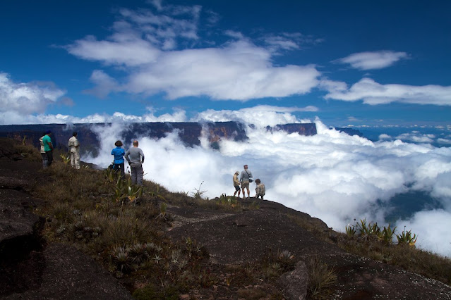
Mount Roraima is like a mountain that has been trimmed to form a cylinder with a horizontal surface. When fog or clouds cover half of the slopes, the mountain seems to float: a phenomenon that is often referred to as the land above the clouds.

Mount Roraima, in Spanish called Cerro Roraima or Monte Roraima. or in Monte Roraímã Portuguese. A mountain with a flat top, or also called a table mountain. It is in the Pakaraima Mountain. (wikipedia.org) The location of this mountain is in the North South America region. Situated right on the border of 3 countries; Guiana, Venezuela, and Brazil.

It stretches from the south in Venezuela to the north, entering parts of Guyana and a small part of Brazil.
Mount Roraima is about 9 miles long and about 9,094 feet high. It is the source of water for Guyana's rivers, and the Amazon and Orinoco river networks.
This Mount Roraima has inspired the novelist Sir Arthur Conan Doyle, to write 'The Lost World'. As well as the animated film “Up” from Pixar and Disney. Mount Roraima is also Guyana's highest point.

The highest point of this mountain is Maverick Rock, at 2810 m. The area of the peak has 31 square kilometers. Protected by 400 meters of cliffs on all sides.
These table mountains are thought to be from some of the oldest geological formations on earth, dating back to about two billion years ago in the Precambrian.

The landscape on its flat top is a maze of rocks with many canyons. Some canyons are several hundred feet deep. Not at all flat as previously thought.
Mount Roraima, “Jurassic Park Forest” in South America

The climate is humid and tropical below (~30°C). Meanwhile, at the top of the plateau it is rather moderate (~10°C) with different weather conditions. Rain can fall here almost every day of the year.
The strangest species here is the tiny black pebble toad, which is believed to predate the dinosaurs. They have a close relationship with the African species. Probably trapped here when the continents separated. Then adapt from time to time to their new habitats. These tiny creatures measure about an inch and cling to a slippery rocky surface. Unable to jump or swim Escape from predators by wrapping themselves up in small balls and bouncing off rocks.
The species was first discovered in 1895. When a biologist set foot on Mount Roraima this.

You can access it from these three countries.
From Guyana, one of the best options is to visit Paruima, which provides access to the foot of the mountain.
However, because the cliff walls are steep, only expert climbers can climb it. The next best option is renting a helicopter to get to the top.
The cliff wall has now been mapped out by rock climbers. They also opened a path to get to the top, with the duration of the climb for two days. But, apart from hikers, adventure lovers, and other special interest travelers, the “ordinary” traveler can fall in love with Mount Roraima for a variety of reasons.

20220521

Statue Christ the Redeemer Rio de Janeiro Brazil

The Story Behind The Statue of Christ The Redeemer


      Christ the Redeemer statue has become one of the new 7 wonders of the world. That's because this statue is a symbol of Christians made of soft rock, namely soapstone and shaped in detail. The Statue of Christ the Redeemer or in Portuguese means Cristo Redentor is a very large statue of Christ which was built using the Art Deco style. (Wikipedia.org) The reason behind the establishment of the Christ the Redeemer Statue, namely as a form of commemorating the independence day of Brazil. This statue has earned the record for being the tallest statue in the world.
Statue Christ the Redeemer

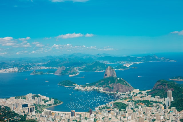
Statue  Christ the Redeemer located at the top of Mount Corcovado, this statue can be seen from all corners of the city of Rio de Janeiro.
In historical moments, the Statue of Christ the Redeemer is often given a visual effect, such as when Brazil won the 2014 World Cup.

This site is a statue of Jesus Christ located in Rio de Janeiro, Brazil which has a height of approximately 30 meters with a weight of 1,145 tons, and a span of 28 meters for arms The statue of Christ the Redeemer or the Statue of Christ the Redeemer was completed and built in 1931 and succeeded in conquering its competitors in online voting or polling.

Standing with his arms spread out and casting a wary gaze over Rio de Janeiro from the 700m- (2,296.6 ft.) Corcovado Mountain, Christ the Redeemer is one of Brazil's most recognizable and photographed monuments.

This site has been renovated several times as a result of the weather there. This was felt in February 2008 and January 2014, when lightning struck some parts of the statue and damaged it. The pale color of Christ's original stone is no longer isolated in sufficient quantities, so instead, it is a color that tends to be dark.

The last development on the statue of Christ the Redeemer was on the 75th anniversary in October 2006. A chapel under Christ was consecrated by the Archbishop of Rio, Cardinal Eusebio Oscar Scheid, enabling baptisms and weddings there. It has also become an important tourist attraction in Rio de Janeiro, attracting an estimated 1,800,000 people yearly. The record number of tourists in one day was at Easter 2011, when 14,000 people went to see the statue.

Along with being the main contender on everyone's bucket list, this new world-crowned wonder can also be reached by hiking through one of Rio de Janeiro's natural wonders: the spectacularly biodiverse and spectacular stretch of tropical rainforest in the Tijuca Forest. You can reach the statue via a small carriage, or enjoy a 50-minute ride accompanied by a habitat for exotic butterflies, monkeys, lizards and plants, which will help place the sculpture's artificial wonders in its stunning natural context.
Rio de Janeiro Brazil

The History of Development of the Statue of Christ the Redeemer

Initially, the young French pastor Pierre-Marie Boss drew attention to Mount Corcovado in 1859. He served as pastor in a small church in what is now the Botafogo district. The church windows overlook Corcovado Mountain. One day, standing by the window, he saw a magnificent sight that inspired him to create a religious monument. Pierre-Marie shared his thoughts with his co-workers, and everyone supported him. The idea was great, but due to lack of funds, it turned out to be impractical. The project was suspended.

In 1882, they decided to build a railroad to the top of the mountain, but not at all due to the monument. In 1884 the road was finished and put into operation. Furthermore, he provided invaluable assistance in the construction of the monument.

In 1921, on the eve of the 100th anniversary of Brazil's independence from the Portuguese kings, urban old people remembered the idea of a French priest and decided to erect a statue. The money for the large-scale project was raised with the help of Cruzeiro magazine, which announced a fundraising campaign (the event went down in history as Monuments Week), and with the help of parishioners from local churches. I have to tell people really liked the idea, and in the shortest possible time they amassed about 2 million flights (this is what Brazilian reals are called in the plural).

Of the three projects, Christ the Redeemer was selected, created by Brazilian engineer Heitor da Silva Costa. A lot of people are working on the project. Among them was the creator of the layout, the artist Carlos Oswald (he suggested creating a statue with outstretched arms). The sculptor Maximilian Paul Landowski was involved in working on the project. Heitor da Silva made a special trip to Paris to meet with Maximilian and engineers Albert Kaku and Heitor Levy. In addition, the sculptor from Romania Georg Leonida (he was in charge of the head of the statue) took part in the project.

The history of the construction of this statue of Christ began in the 16th century by determining the peak of Mount Corcovado as the location where the statue was made. This is because the shape of the Corcovado mountain is similar to the hump and you can see the peak of the mountain from various corners of the city in Brazil.

The statue of Christ the Redeemer was completed on October 12, 1931 and on the same date the statue of Christ the Redeemer was unveiled and introduced to all corners of the world.

Even today, the process of building the statue is still continuing, for example, providing some decorations such as lights around the statue, and also building a panoramic elevator which will make it easier for tourists when they want to visit this place, and also build a motorized stairs to make it easier for the elderly and people with disabilities to go to this place, all of which took about 5 years to be completely finished and inaugurated.

Some additional information on tourist attractions Christ the Redeemer statue:
- The opening hours for the statue of Christ tourist attractions are every day, and they close until around 8 pm.
- The price of admission to this place is divided into two, where for adults it is R$ 50.00, while for children aged between 6 to 12 years it is R$ 25.00.
- As for children under the age of 6 years, there is no charge.
- You can get there using public transportation, or you can walk if it's a short distance from where you are.

20220519

Chichen Itza The Mexico Tourism and Vacations

Chichen Itza: The New Wonder of The World 


      While pyramid ruins like El Castillo and Kukulcan are the main reasons to visit Chichen Itza, there are many other attractions on offer here. Amazing bird-watching and stargazing experiences can be found at the Maya Protected Forest and Bird Sanctuary at Hacienda Chichen. One-day excursions can be started from Merida or Cancun.
Chichen Itza

In the 9th century, Chichen Itza was a de facto regional city center, its rulers controlling much of the northern and central Yucatan peninsula. Through its port on Isla Cerritos on the northern coast, Chichen Itza became an important commercial center, trading goods, including gold and other treasures.

At the height of the Mayan civilization, it is believed that as many as 50,000 people lived in the center of the city of Chichen Itza. The population may also have been quite diverse, since at least by the standards of the time many people had immigrated to the city from outside the Yucatan, including from Central America.

History of Chichen Itza, the City of Mayan Civilization in Yucatan

Chichen Itza is a town of the Mayan civilization. Chichen Itza is located about 120 miles from the modern resort city of Cancun, on the Yucatan Peninsula, Mexico. Chichen Itza was named a UNESCO World Heritage Site in 1988, and in 2007, was selected in a global survey as one of the New Seven Wonders of the World. Although Chichen Itza is a hugely popular tourist attraction, archaeologists are still actively exploring the Mayan culture and achievements in the ancient city's center. (wikitravel.org)

The name Chichen Itza is a Mayan term meaning "mouth of Itza's well". The Itza are a Mayan ethnic group that rose to power in the northern part of the Yucatan peninsula, where the town of Chichen Itza is located. The "well" in the name "Chichen Itza" refers to a number of underground rivers that flow beneath the area, and serve as a water source for the city.

There are several different historical accounts about when Chichen Itza was built and eventually developed into a center of political and economic power. Some records say the founding of the city of Chichen Itza occurred in the early 400s AD. While others say the construction of the city began several years later, in the mid-5th century. 

Certainly, Chichen Itza became a significant center of economic and political activity in the Maya civilization around 600 AD. In 600 AD, Chichen Itza had already become one of the largest cities in the Mayan civilization. It covers almost two square miles of commercial, residential, and other structures made of stone. Chichen Itza even has its own “suburb,” with small houses occupying the outskirts of the city.

The Temples and Buildings at Chichen Itza:

Kukulkan Temple
In the complex of buildings built by the Mayans and Toltecs there is a pyramid-shaped temple, the temple is named the Kukulkan Temple. On each side of the pyramid there are steps leading to the top. At the top of the stairs is the entrance to the room containing the Jaguar King Kukulkan Stone Crown.
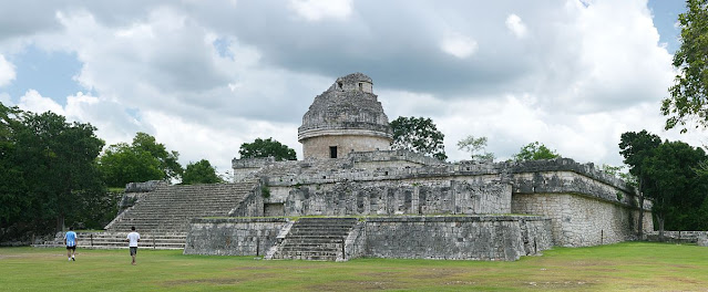
El Caracol Mexico

El Caracol
Besides the Kukulkan temple, another tourist attraction that you can visit when in Chichen Itza is El Caracol. El Caracol is a temple in the form of a circle and a rectangular platform that is commonly used as an astronomical observatory room.

20220509

Machu Picchu Mysterious Tourist Spot

Things You Should Know About Machu Picchu


     No wonder Machu Picchu is Peru's most popular site. This stunning structure dating from the mid-1400s is made of limestone without mortar and built on a plateau deep in the heart of the Amazon jungle. Visit this place by train from Cusco or, if you're adventurous, take a day trip on a hiking trail. You will pass through the deep ravines of the Andes mountains and enjoy the stunning views.

Machu Picchu Peru's Mysterious Ancient Tour

Machu Picchu or often referred to as the lost city of the Incas is the remains of the ruins of civilization like the Incas. Situated in a mountainous area with an elevation of more than 2,400 meters, Machu Picchu is a symbol of the Inca empire that was founded in 1450.

Machu Picchu or frequently referred to as the lost city of the Incas is the remains of the ruins of civilization like the Incas. Set in a mountainous area with an elevation of more than 2,400 meters, Machu Picchu is a symbol of the Inca empire that was founded in 1450.

Below are the several best tours of Machu Picchu.

Holy Valley, Peru
For those with an itineraries that are wide open and deep pockets, this 5 day tour of the Sacred Valley and Machu Picchu from Cusco will be a great way to immerse yourself in the amazing sites and culture that attract visitors from all over the world.
The tour includes all site entry fees, meals listed on the itinerary and 4 nights accommodation while traveling.
Some tours offer a variety of activities included in these activities, and these are a great option for those who prefer to let tourism professionals and experienced locals handle all the small details.
It's a once in a lifetime opportunity, so take it if you can.

Machu Picchu Tour from Cusco
Most Machu Picchu tours start in Cusco, and although you could spend days seeing all there is to see in the area, a full day tour is more than adequate for most travelers, and that leaves plenty of time available for other adventures.
It is one of the wonders of the New World that rivals the Great Wall or the temple complexes at Angkor Wat, and for first-time visitors, it's an exhilarating experience.
You'll be taken by train to Machu Picchu, and much of the journey will be the same route taken by Spanish conquistadors in previous centuries who missed complete completion in search of Peruvian gold.
Inca Forest Tour from Cusco
                                                              Image from wikimedia.org
Inca Forest Tour from Cusco
If you've already experienced Machu Picchu or are just looking for something new and unique, this alternative jungle excursion will be perfect.
Since it includes cycling, white water rafting, sunbathing and hiking through fairly dense bush, it may not be a match for your fat, older Aunt Edna, but for the young, brave and physically fit it will be something. that you love and will remember for a long time.
Tours include visits to some of the well-known sites, and some that are less frequented in more remote areas, so you don't have to worry about crowds.

The Moray Salt Mine and the Machu Picchu Combo
Peru's Urubamba Valley lies about halfway between Cusco and Machu Picchu, and since it's an route it's a convenient place to stop and check out some of the towns with colonial architecture, narrow streets, and Inca forts that still stand outside the city limits.
The tour includes round-trip transportation from your hotel in Cusco, and includes a tour of the Moray Salt Mines, a Vistadome train ride to Aguas Calientes, and entrance to the sites at Machu Picchu.
Regular lodging and meals are included in the itinerary, and most guests who have been on the tour agree that 2 days is the perfect amount of time.


While touring Machu Picchu, you can see two well-marked sectors separated by a wall about 400 meters long. One is oriented towards agriculture and the other is more urban. Agricultural areas are characterized by terraces or platforms used for the cultivation of various foods. Very close to this area, there are several small houses that could be a place to live for farmers. On the other hand, in the urban area of the Royal Residence, there is Plaza Sagrada, the main ceremonial site of the city; The Pyramid of Intihuatana, where the large sundial is located; The Grupo de las Tres Portadas, a group of buildings made up of three large portals and the Grupo del Cóndor, which includes a shrine for ceremonial use.