Showing posts with label USA. Show all posts

20221020

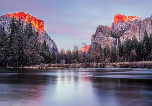
Yosemite National Park, California Nature Destinations

The Beauty of Yosemite National Park Can Make Your Heart Calm 


      Yosemite is one of the National Parks in the United States located in the Sierra Nevada Mountains of California. This National Park is very popular throughout the world, because it has amazing natural scenery.
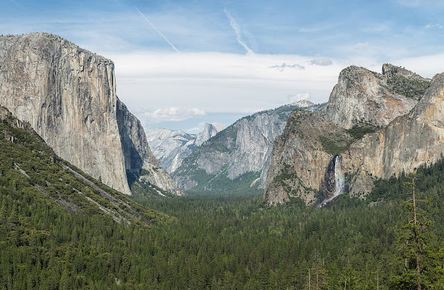
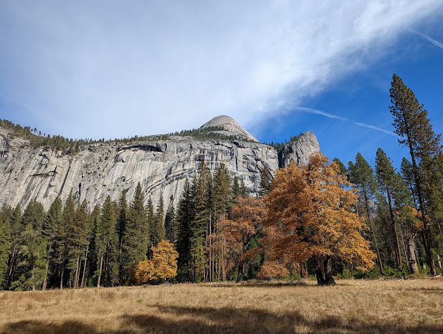
In Yosemite National Park, you can enjoy the beauty of the granite cliffs, crystal clear waterfalls, and see sequoia trees that are hundreds of years old.
In addition, the Yosemite Valley is also a must-see for its waterfalls and the stunning granite monolith called the Half Dome. There are also several attractions in this national park, such as vast meadows, giant sequoias, vast wilderness areas, to deep valleys.

Yosemite National Park California USA
                                                         Image Source: wikimedia.org

One of the tourist destinations that is on the bucket list of nature lovers is Yosemite National Park in California, United States. The park broke a visit record in 2016, surpassing five million visitors for the first time in its history. On October 1, 1890, Yosemite National Park was established.
There is no doubt about the beautiful and amazing natural panorama in Yosemite National Park.
This national park is also famous for its waterfalls, such as Yosemite Falls, Sentinel Falls, Ribbon Falls, Horsetail Falls, to Bridalveil Falls.

There are several wildlife, such as bears, squirrels, deer, and mountain lions.
It has been noted that deer and squirrels hurt more people than bears and mountain lions. Therefore, tourists are advised to exercise caution when encountering wildlife.
Park officials advise tourists when they see wildlife not to feed them, approach them or allow them to approach.

Yosemite National Park, California Nature Destinations

This exotic nature reserve in California can be reached with a trip of approximately 4 hours. The naturalness of this national park is really well preserved, so it is not affected by technological developments.
Consequently, visitors cannot receive telephone signals and internet signals, because they cannot build telephone towers there.

Yosemite is arguably the most popular national park in America. The Yosemite Valley has an area of about 18 sq km. The valley area is only half a percent of the total area of this national park.

Yosemite National Park has El Capitan which is a collection of granite that stands vertically.
It is a favorite place for rock climbers. If you visit this national park, don't forget to climb one of the granite mountains there, namely the Sentinel Dome.

At the beginning, the tourists do not need to use a protective barrier to get to the top. But the terrain that must be passed is considered extreme, because it is not equipped with safety on the right and left sides. So you should be careful.
The higher you go, the more difficult the terrain is. But don't worry, the route has been installed with protective ropes on the right and left to prevent travelers from falling. Once at the top, the view that is presented is truly extraordinary and able to make up for all the fatigue while climbing.

Yosemite National Park Scenic California

You can stay overnight, eat, or shop around the national park, namely in Yosemite Village.
The village has shops, restaurants, inns, the Yosemite Museum, and the Ansel Adams Gallery, with black-and-white prints of the area's famous photographers.

Yosemite Valley is open year-round, various activities are available through the National Park Service, Yosemite Conservancy, and Aramark in Yosemite.
These services include nature walks, photography and art classes, stargazing programs, tours, bike rentals, white water rafting, horse riding and rock climbing classes.
20221014

Sightseeing the San Antonio River Walk

San Antonio River Walk, Pedestrian with Beautiful Surroundings


      In the state of Texas, precisely in the city of San Antonio, Texas, there is one of the interesting tourist attractions, known as the River Walk.
This tourist spot is a promenade along the San Antonio River. which is packed with stunning architecture, as well as lush green landscapes. Besides being able to explore the river by boat, you can also taste typical Texas cuisine.

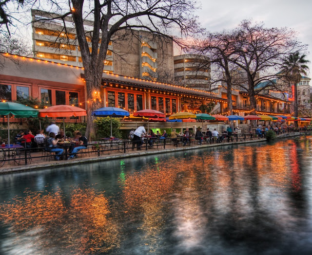
San Antonio River Walk Restaurants and Shops
                                                             Image Source: flickr.com

San Antonio River Walk located in the second largest state in the United States, San Antonio is a beautiful and attractive city, which is perfect for those of you who are planning a vacation to Texas. Storing several historical buildings with a city center that is always crowded with tourists, you can have an adventure and enjoy the night atmosphere by the river.

Here you can find cobbled paths with rows of restaurants lining the San Antonio riverbank. The calm river flow makes the River Walk area look beautiful, especially at night.

The presence of instagenic bridges, shady trees along the banks of the river, and birds flying make The San Antonio River Walk never run out of visitors. Most tourists come here just for sightseeing or enjoying culinary delights in one of the restaurants.

San Antonio River Walk

The best way to enjoy the San Antonio River Walk is to take a tour down the river by boat. This boat can accommodate 20-40 passengers. The boat tour is deliberately slow so that you can be content to enjoy every corner of the River Walk as well as take selfies.
You can also make a tour reservation as well as a dinner cruise on this boat, which is certainly very romantic.

The River Walk is a successful special river arrangement, located one level below the driveway.
The River Walk loops and meanders under a bridge and two parallel walkways, flanked by restaurants and shops, linking the main attractions from the shops at Rivercenter, Arneson River Theatre, Marriage Island, La Villita, to HemisFair Park, Tower Life Building , the San Antonio Art Museum, the Pearl and the five Spanish colonial missions of the city, which have been considered World Heritage Sites, including the Alamo.
During the annual spring season at the Fiesta San Antonio, there is a River Parade featuring flowers floating on the river.

History of San Antonio River Arrangement

In September 1921, flooding caused by the overflow of the San Antonio River, which claimed up to 50 lives. The local government later developed a master plan for river flood control.
Among those plans, there are plans to build an upstream dam (Olmos Dam) and cut a prominent river bend in the current Downtown area (between Houston Street and Villita Parkway), then pave the bend at the corner, and build a sewer.

Work began on the Olmos Dam and bypass channel in 1926. However, the San Antonio Conservation Society successfully protested against plans for a paved sewer. No master plan was developed until 1929, until the native and San Antonio architect Robert Hugman proposed his plans to develop the River Walk.

Although many were involved in the development of the site, the leadership of former mayor Jack White was credited with being instrumental in addressing the issue of the bonds that raised funds, to power the 1938 San Antonio River Management Project, which became the river's evolution, providing the 2.5-mile River Walk.

San Antonio River Walk Bridge
                                                           Image Source: wikimedia.org

Hugman supports the idea of a bypass channel, but, instead of paving the way for a bend in a river, Hugman suggests things that are more important:
the flood gate at the north end (upstream) of the bend of the river;
a small dam at the south end (downstream) of the river bend; and
Tainter gate in river channel to regulate water flow.
The river bend was then surrounded by a commercial development, entitled "The Shops of Aragon and Romula".
Hugman went further to maintain his architect's office along the bend of the river.

Hugman's plan was not received well at first, as the area was known to be dangerous. On one point. People were warned about the threat of drowning in the event of river flooding. However, over the following decades support for commercial development on the bend of the river grew.

In early 2016, for the first time in history, the River Walk was connected to another linear urban road, namely the San Pedro Creek Greenway. The Greenway joins the River Walk at the confluence of the San Pedro and San Antonio Rivers near the Mission Concepcion.

The River Walk has inspired many other cities, such as the Little Sugar Creek Greenway in Charlotte, North Carolina, Cherry Creek Greenway in Denver, Colorado, The Bricktown Canal in Oklahoma City, Oklahoma, and the Santa LucĂ­a Riverwalk in Monterrey, Mexico.

20221012

Enjoy the Beauty of Venice Beach, Los Angeles

Things to do in Venice, Los Angeles


     The beach has always been one of the traveler's favorite destinations. There are many beaches in the world, from the very popular to the unspoiled. 
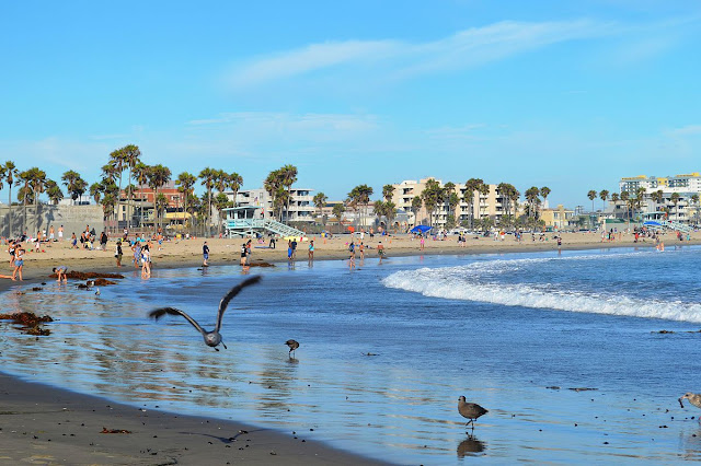
Venice Beach Los Angeles is one of the best tourist spots in the United States. Venice is one of the most beautiful beaches in the world. Venice Beach lies between Santa Monica and Los Angeles Airport.

Venice Beach Los Angeles
                                                          Image Source: wikimedia.org

Not only is it a popular beach, there is also the popular Venice Beach Boardwalk around Venice beach.
It's a truly entertaining tourist spot, where there are plenty of street performers dancing, sculpting, and singing for passers-by. There are also many souvenir shops and restaurants that you can visit.

Enjoy ocean views, sea breezes, and a pleasant atmosphere on a Venice vacation. You can book a hotel around Venice Beach (it is only about 1 kilometer from the beach).

Venice Beach is the perfect location to enjoy the sun, sand and sea year-round. The area is equipped with a 2.5-mile walkway that is intended for pedestrians only.

In addition to swimming and surfing, you can rent a bicycle to ride between Venice Beach and nearby Santa Monica.
There is an adjoining skating rink, a well-equipped gymnasium, Venice Pier, and an extensive canal system.

Venice Beach Boardwalk Los Angeles

Venice Beach Boardwalk

Venice Beach Boardwalk is No. 2 on the list of Top Los Angeles Attractions, with 16 million visitors a year.
This is also one of the top free things you can do in LA.
Ocean Front Walk is a 3 mile stretch of boardwalk along Venice Beach. Over a mile it is lined with funky shops, cafes and vending stands.
Colorful street artists entertain visitors. Muscle Beach's outdoor gym, gymnasium, handball court, tennis courts, beach volleyball court, paved skateboard park, and skate dancing plaza attract well-built travelers for public exercise.

The Venice Beach Bike Path

The Venice Beach Bike Path

The Venice Beach Bike Path is a concrete bike path that runs between a wooden walkway and sand, and continues up the coast via Santa Monica, making it a great place for biking and rollerblading.
Taking a detour around Marina del Rey , you can also continue cycling south to Redondo Beach. Bike or skate rentals are available at Venice Beach bike rental locations.

Venice Canals Los Angeles

Venice Canals

When Abbot Kinney undertook the construction of Venice in 1905, he had 16 miles of canals dug to drain the swamp, for housing development.
The majority of the canals were paved in the 1920s to make way for new horseless carriages, but a few blocks of canals remain south of Venice Blvd, about a block from the beach.
Although many of the houses around the canal have begun to crumble, most have been restored, creating a cute area for walking or paddling. The canals are a bit dry in the summer.

20220928

American White House Tour Requirements

Want to Try a Tour Around the White House of America? Read the Terms


      The White House or The White House in Washington, D.C., United States (US), has reopened free tours for the general public, starting April 15, 2022. 
The Biden-Harris Administration is pleased to announce that a public tour of the White House will commence on Friday, April 15, 2022. This tour will be available every Friday to Saturday, except Sundays. holidays, from 08.00 to 12.30 local time. (whitehouse.gov)
However, please keep in mind that the tour schedule can change at any time, especially if the weather is bad or there is a state event.

White House Washington DC USA
                                                          Image Source: wikimedia.org

The White House is the US state palace, as well as where the US President works. It was founded in 1972 on the brainchild of the first US President, George Washington.

How to Register for a White House Tour

Prospective tour participants are required to submit an application in advance on a first come, first served basis.
Applications may be made to members of the US Congress and to the Congressional Tour Coordinator.
For foreign nationals (foreigners), they can contact the embassy of their home country.
Applications must be submitted at least 21 days prior to the day of visit, and no later than 90 days before the desired tour date.

Activities During White House Tour

The White House tour will last about an hour. Tour participants will be invited to visit a number of well-known areas, including private cinemas; East Room, which is often seen during press conferences, or other special occasions; State Dining Room (banquet hall), and a ceremony room for state occasions; and the Blue Room, which is famous for its holiday decorations.

White House State Dining Room
                                                         White House State Dining Room

Tourists are also advised to visit the White House Visitor Center, which is open every Wednesday - Thursday, 11.00 - 16.00 local time. The area houses approximately 100 historical artifacts, and offers tours of the White House via interactive touchscreen facilities.

Items Not Allowed on the White House Tour

Visitors aged 18 years and over are required to present a valid identity document, while foreigners are required to show their passports. Photocopies and identification documents that have expired will not be accepted.
A number of items are not allowed during a White House tour. Luggage storage facilities will not be provided at the White House compound. Visitors with prohibited items will not be allowed to enter.

Items that are not allowed to be carried are:
1. Video cameras, detachable-lens cameras, tablets, iPads, tripods, monopods and selfie sticks.
2. Different types of bags (handbags, backpacks, small bags, diaper bags, camera bags).
3. Sharp objects, including folding knives.
4. Stroller or baby carriage.
5. Food, liquids, aerosols, and personal care items, including make-up and lotion.
6. Guns, ammunition, fireworks, electric stun guns, toy guns, knives, and devices related to martial arts.

Participants on the White House tour may still bring a compact camera with a lens less than three inches or 7.62 centimeters (cm) long, an umbrella with a non-metallic tip, a wallet, a smartphone in silent mode, and medical items, such as: wheelchairs. During the tour, participants are not allowed to record videos, they can only take pictures.

20220918

Visit Kennedy Space Center at Cape Canaveral

Kennedy Space Center For Space Enthusiasts


      Bored with city and nature tours? Educational tours about space may be your choice.
Some of you may want to know everything about outer space, from books, content on the internet to movies and scientific research.

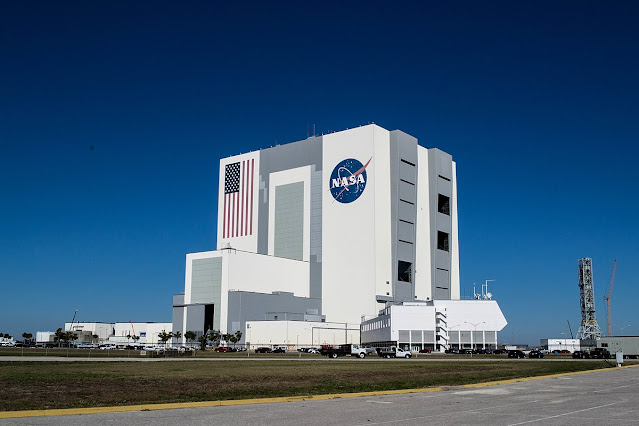
Kennedy Space Center

The Kennedy Space Center provides an opportunity for visitors to get to know the spacecraft up close. Kennedy Space Center is one of Earth's most popular space experiences. It is one of NASA's ten field centers, so visitors can imagine what it's like to be here. The spacecraft was created in 1962, and has become a hot spot for space enthusiasts. (nasa.gov)

The Kennedy Space Center, located on the coast of Florida, is a suitable tourist spot for those of you who love technology and outer space. The Kennedy Space Center has been the launch site for every US space flight since 1968, and is now open to the public, so that tourists can learn more about the early pioneers into space, and they can experience the thrill and excitement of visiting this place too.

The Kennedy Space Center (KSC) is the NASA space launch center. In 1969, Apollo 11 was launched from this place and carried the first man to land on the moon. Unmanned shuttles are still launched regularly today, so check before coming, to see if your scheduled visit coincides with any of these dramatic events.

The Kennedy Space Center covers 56,656 hectares, six times the area of Manhattan, New York. Its main attractions are in the number of hangar-shaped structures dotted around it, including photos showing the construction and use of the space shuttle's earliest launch pads.

All visits will start at the Kennedy Space Center Visitor Complex, where tour buses depart every 15 minutes. This self-guided tour is included in the price of admission, so feel free to hop on or off this bus as often as you like.
The interesting thing that will be seen when the bus passes is the shuttle launch site. There is also a stop at the Apollo/Saturn V Center for viewing the rocket to the moon. Tours guided by trained space experts are also available for an additional fee, and are required to be booked in advance.

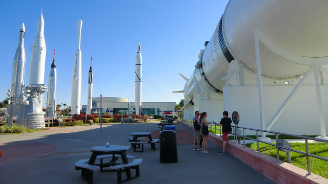
Upon your return to the Kennedy Space Center Visitor Complex, visit Rocket Garden to see the early generation space shuttles that made space exploration possible. Step into a more modern model to see where the astronauts sleep on the space shuttle. At the Shuttle Launch Experience, tourists can hop on an interactive simulator featuring a virtual journey into space. After the "landing", visitors can also discuss with veterans of the US space program about the simulation.

Kennedy Space Center USA
                                                               Image source: flickr.com

In the United States Astronaut Hall of Fame, visitors can view a variety of artifacts and objects commemorating the astronauts who first went to space. There is also a large collection of personal memorabilia of the astronauts.

Visitors can chat with veteran space travelers through the Astronaut Luncheon. You must book in advance for this hour-long experience, which is subject to additional fees.

It's a good idea to arrive just as KSC opens to ensure there's enough time to see all the objects on display, take a tour, and watch one of the IMAX movies, all of which are included in the price of admission. It's best to spend a full day visiting KSC, including a few hours in the United States Astronaut Hall of Fame.

20220913

Denali National Park, Alaska: Things to See

What Activities are Available in Denali National Park?


       Denali is a national park in Alaska. There is Mount McKinley in this national park, which is North America's highest mountain. This National Park functions to protect the native area from various animals such as: grizzly bears, moose, caribou, wolves, and so on.

Mount McKinley Denali National Park Alaska USA
                                                           Image Source: wikimedia.org

A visit to Alaska Denali National Park and Preservation is a unique adventure. It's an opportunity to spend a vacation amongst spectacular views and diverse wildlife, gazing at Mount McKinley and the jagged peaks of Alaska's mountains.
Alaska's interior taiga and tundra landscape provides a rare experience. Denali National Park is a vast wilderness, mostly inaccessible to vehicular traffic, most tourist activity within the park takes place in the northeastern part of the park.

The main visitor center is located at the northeastern entrance of Denali National Park. You should explore these facilities at the start of your visit, to get used to what you will see and do in the park, to know about tours and activities, and to learn from the interesting exhibits. Featuring interpretations, animal models, and hands-on activities provide the opportunity to learn about the flora and fauna that live through harsh winters and short summers. The visitor's center film, "Heartbeats of Denali", is excellent, full of pictures of wildlife and the changing seasons.

The Denali Visitor Center is part of a complex of facilities that also includes: Alaska Railroad Depot, Murie Science and Learning Center, Alaska Geographic Bookstore, restrooms and Morino's Grill. Several hiking and cycling trails can be accessed from the visitor center complex.

Denali National Park, Alaska

Very few vehicles are allowed more than 15 miles into the park, so if you want a chance to see the sights and wildlife there, a tour bus is the way to go.
This tour is taking a full day, between 4.5 to 11 hours. All tours are led by an expert driver. Make sure to layer up and bring your camera and binoculars. You probably won't have many opportunities to hike, but you can get out there and stretch your legs, and take some photos. The wide open windows of the bus allow you to take some decent enough pictures from your seat.

Denali Natural History Tour (4.5 hours)
This tour focuses on how humans lived and experienced the park, from Alaskan natives to the earliest explorers, settlers, and visitors.

Tundra Wilderness Tour (8 hours)
The most popular of all, this tour focuses on the soil, plants and animals that live within the park. Buses stop frequently to get a closer look at wildlife, such as: grizzly bears, deer, wolves and caribou.
Drivers carry zoom-lensed video equipment, using them to provide a live view of the distant wildlife, which can be viewed on the drop-down screens on each bus seat, making it easy for you to spot wildlife wherever it is.

Kantishna Experience Tour (11 hours)
This tour covers approximately 90 miles of trails leading to the park and is a good option for those who want to see as much of the Denali wilderness landscape as possible. This is the only tour that stops at the Eielson Visitor Centre, which is located 66 miles into the park. A National Parks Ranger joins the bus for the final part of the tour of Wonder Lake.

20220825

Brief History of Mount Rushmore USA

Why Was Mount Rushmore Constructed?


     In addition to the Statue of Liberty and the White House, the United States (US) has a distinctive and famous icon, namely the carvings of the faces of the four American presidents on Mount Rushmore. Not only is it a symbol of the greatness of the land of Uncle Sam, Mount Rushmore also has a number of unique histories that not many people know about.

Mount Rushmore USA
                                                          Image Source: Wikimedia.org

The Mount Rushmore National Memorial is a sculpture of a face carved into the granite of Mount Rushmore, a batholith in the Black Hills in Keystone, South Dakota, United States. Sculptor Gutzon Borglum created the designs of the sculpture and oversaw the execution of the project from 1927 to 1941 with the help of his son, Lincoln Borglum.

  Mount Rushmore features a 60-foot (18 m) statue of the heads of four United States presidents: George Washington (1732–1799), Thomas Jefferson (1743–1826), Theodore Roosevelt (1858–1919), and Abraham Lincoln (1809–1865) . The memorial garden covers 1,278.45 acres (2.00 sq mi; 5.17 km) and 5,725 feet (1,745 m) above sea level.

South Dakota historian Doane Robinson is credited with understanding the idea of carving the faces of famous people into the Black Hills region of South Dakota, in order to promote tourism in the region. Robinson's original idea was to carve the Needles;

However, Gutzon Borglum turned down the Needles because of the poor quality of the granite and strong opposition from Native American groups. They settled on Mount Rushmore, which also has the advantage of facing the southeast for maximum sun exposure. Robinson wanted it to feature Western American heroes like Lewis and Clark, Red Cloud, and Buffalo Bill Cody, but Borglum decided the statue had to have a wider appeal and chose four presidents.

https://comMount Rushmore National Memorial Mount Rushmore.

After securing federal funding through the sponsorship of US Senator Peter Norbeck (Mount Rushmore's great political patron), construction began in 1927, and the presidential face was completed between 1934 and 1939. After Gutzon Borglum's death in March 1941, Lincoln Borglum's son, took over. position as a construction project leader.

Every president was originally sculpted from head to waist. A lack of funding forced construction to end on 31 October 1941.
Mount Rushmore has become an iconic symbol of the United States of America, and It attracts more than two million travelers each year.

The project's architect Borglum had a vision for Mount Rushmore that went beyond the heads of four presidents. He wanted to build a room called the Hall of Records behind Lincoln's head that would be used to keep some of America's most important documents.

The room measures 80 feet (24 meters) high and 100 feet (30 meters) long. He envisioned there would be a brass cupboard that would hold the Declaration of Independence and the Constitution.
Unfortunately, these plans were never completed despite workers having built a 70-foot-long space.
Borglum died in the middle of the project and the money ran out so the project was abandoned.

In 1998, a total of 16 porcelain panels explaining the history of the United States and Mount Rushmore were placed in the hall. This hall is not open to the public and is only meant to be a time capsule.

The local Native Americans opposed the creation of a statue of Mount Rushmore to this day.
During the construction of the Mount Rushmore statue, the Native American Lakota Sioux strongly opposed the project for having to 'cut up' the sacred Black Hills. They oppose putting the faces of presidents who support the killing of Native Americans. But despite these criticisms, the site was still established and is still considered controversial today.

20220818

Times Square Facts That You Didn't Know

Times Square, New York Travel and Entertainment Destination


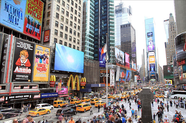
     Times Square has been known as one of the heart of New York City, United States. Every day, this place is almost never deserted from the bustle of US citizens who are active.

New York Times Square
                                                        Image Source: Wikimedia.org

As the busiest pedestrian area in the world, Times Square is also the center of the Broadway Theater District and the world's entertainment industry. The Broadway theater district lies in the middle of Times Square. Hundreds of theater lovers usually line up at the TIX outdoor ticket booth for half-price tickets the afternoon before a show at one of the 40 theaters. No wonder Times Square is one of the most visited tourist spots in the world.

Previously, this place was known as the Longacre Square. Then, in 1904, it was renamed Times Square.
The name change came after The New York Times moved its headquarters to the newly erected Times Building, which is now One Times Square.

As the venue for the annual New Year's Eve ball party that began on December 31, 1907, Times Square also serves as the city square in New York.
The Times Square area, especially its bustling intersection, has often been the setting for stories in literature, television, film, music videos, and video games.
Times Square is easily recognized by viewers and viewers, so there are often scenes of Times Square being attacked and destroyed in various films.

Well, if you go to New York City, United States of America, don't take your time to Times Square.
The busiest pedestrian area in the world has become a vacation destination for tourists from all over the world.

Since the 1900s, Times Square has been the center of the theater district in New York. There are many ancient theater buildings standing today.
You can see the remains of the magnificent theatre, such as the former Loews Mayfair Theater which is now a gift shop on 47th Street and 7th Ave, among other places.

Times Square Panorama at Night

Times Square is full of memorabilia shops, from high-end to low-key, where you can buy souvenirs like “I Heart NYC” T-shirts and New York Yankees hats. Plus, there's a wide variety of places to go for food, from fast food restaurants to famous New York restaurants that serve huge bowls of Matzo beef stew and giant sandwiches.

Those with a sweet tooth can pick up snacks at M&M's and Hershey's expansive chocolate shops. Those of you who want to watch the chaos and crowds can bring a chair and sit in the center of the field which is closed to traffic. Or, catch a movie at one of the large multiplex theaters in the area.

Lastly, Times Square is lined with majestic high rise buildings, as well as billboards, making this place very luminous.
In fact, Times Square's gleam at night can be seen from space, because it is so contrasting with the surrounding area.
Satellite photos even show how the Times Square area is yellowish, due to the gleam of the city lights compared to the area around it.

20220816

Visit the Yellowstone National Park USA

Yellowstone National Park Facts and Enchantments

 
      Yellowstone, founded in 1872, is the oldest national park in the United States, and one of the most popular parks in the nation. Spread across the basalt plateau in the northwest corner of Wyoming, a vast wilderness area extends as far as neighboring Idaho and Montana, and forms the heart of the Great Yellowstone Ecosystem, one of the largest and best-preserved climate zone ecosystems on the planet.

Yellowstone Park is known for its spectacular views, diverse flora and fauna, and geothermal wonders. Yellowstone boasts the world's largest number of active geysers, and offers a window into the forces deep beneath the earth's crust, the same forces that make up the park.
The scenery ranges from winding rivers and green valleys, vast lakes, and thundering waterfalls.

Yellowstone is a land of unique and contrasting. Each season paints a different landscape, from the lush greens of spring, and the sparkling summer heat, when herds of bulls and deer graze along the riverbanks.
At any time of year, Yellowstone is a reminder of the amazing wilderness, and abundant wildlife, that once covered much of the planet, and that offers unforgettable safari adventures in the wild American West.

The best way to tour Yellowstone National Park is, by driving around the Grand Loop, a 142-mile long, winding road in a figure eight past the park's most striking natural features.
Well-maintained hiking trails offer stunning views of nature, and many trails are wheelchair friendly. Driving the entire length of both loops can take between four to seven hours, depending on traffic. In the hot summer months, traffic can stop-and-go along the way.

Old Faithful
                                                            Image Source: Wikimedia.org

Old Faithful

The geyser known as Old Faithful, because of its regular eruptions, shoots columns of water high into the air. Witnessing this magnificent sight is one of the most popular things you should do in Yellowstone. Although the eruption interval is not quite regular as in the past. They now vary from 35 minutes to 120 minutes, with a mean interval of about 92 minutes.
Old Faithful is not the largest geyser in the park, but it explodes more frequently than any other large geyser in the park.

Lower Geyser Basin

Lower Geyser Basin

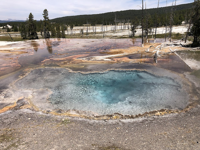
The Lower Geyser Basin offers more hot springs than any other area in the park. The boardwalk takes you to what it's known for: the Fountain Paint Pot, which boils with hot, reddish-colored mud. Slightly south of here on the popular three miles is Firehole Lake Drive (Great Fountain Geyser), a magnificent spectacle every 9-15 hours, when it shoots water 75 to 220 feet into the air. On the lush greens of the Fountain Flats, bulls and deer often graze, especially in the morning and evening.

Midway Geyser Basin & Grand Prismatic Spring

Midway Geyser Basin & Grand Prismatic Spring

Named the Midway Geyser Basin & Grand Prismatic Spring for its location between the Upper and Lower Geyser Basins, the Midway Geyser Basin has two of the largest geothermal features in Yellowstone. The crater of the Excelsior Geyser throws 55 gallons of hot water per second into the Firehole River. Nearby is a beautiful view of the 370-foot Great Prismatic Spring, one of Yellowstone's best and largest hot springs.

Norris Geyser Basin

Norris Geyser Basin

The Norris Geyser Basin is reputed to be the oldest, hottest and most hydrothermally active geyser in Yellowstone. The basin includes two main areas that are open to visitors, and are accessible via a circular path: The Porcelain Basin is like a gloomy, treeless moon, immersed in the pungent aroma of bubbling geysers, which surround a three-quarter mile trail.

Hayden Valley

Hayden Valley

Often dotted with great herds of bison, the scenic Hayden Valley is a prime spot for wildlife viewing. In the spring and early summer, grizzly bears often roam here looking for bison and newborn deer. Coyotes are also easily found in green pastures. Birders will also have lots of things to see. Bald eagles, northern grasshoppers, sand storks, shorebirds, ducks, geese, and pelicans are some of the species that inhabit areas around mudflats and rivers.

Best Time To Visit Yellowstone

The best months for visiting Yellowstone are April, September and October. These “off-season” months give you more opportunities to see the local wildlife, and are less crowded. Bears emerge from hibernation between March and April, migratory birds arrive just before May, and moose activity begins mid-September.

20220814

Florida Keys, America's Top Tourist Attractions

Florida Keys Travel Guide & Attractions


      The most beautiful tourist attractions in America are Florida Beach. A collection of rocks located in the Florida keys, One of the most popular tourist spots for travelers from all over the world.
Florida is one of the states of the US. When people hear Florida, many people immediately think of Florida's sunshine, beaches, theme parks and oranges. In Florida, you can do various kinds of fun activities.

Florida Keys USA

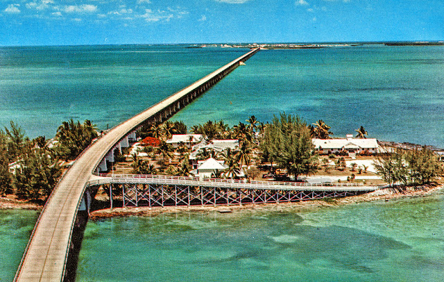
The Florida Keys are a 120-mile-long tropical island chain that curves around the base of the Florida Peninsula, connected to the mainland by a series of bridges. The bridge that connects them is the Seven Mile Bridge in the Lower Keys, which is a popular bridge and is often the location of filming.
The waters around these islands are protected by marine sanctuaries and contain many species of water and coral reefs. You can visit many small and beautiful islands in the Florida Keys.

In this place, local tourists can enjoy a tropical vacation without leaving their own country, Things to do in florida keys are: scuba diving, fishing, snorkeling, boating, kayaking sailing and eco tourism.
You can enjoy the atmosphere of the Florida sea at night without waves, Reef fishing is very favorite on the Florida coast, Likewise enjoying a cruise using a cruise ship that can spoil tourists to sunbathe on the boat, while enjoying the beauty of the Florida beach.

The attraction of the Florida Keys is not only because of the wide roads and long bridges connecting them, but also because of its coastal ecosystem, especially coral reefs, as well as other natural attractions. Almost all the giant dive companies have major outlets in the region. The proximity of the dyke to the Caribbean region also raises the question of how the influence of the 'reggae' people on the culture that exists in the dyke.

Florida Keys Bridge
                                                         Image Source: Wikimedia.org

Florida keys has a length of approximately 110 miles, and each island is connected by a bridge called the Overseas Highways. 
There are five interesting spots in the Florida Keys, namely 
Key Largo, a place where you can enjoy the underwater beauty, 
Islamorada, is well known as a sport fishing spot.
Marathon, which offers a variety of resorts for relaxing, 
Big Pine Key, which provides various types of tours for tourists who want to tour the city of Florida, Florida Beach is also known as the Last Resort.

Best Time to Visit Florida Keys

Best time to visit Key West is between March and May. Winter crowds will dwindle, hotel rates are back to being reasonable and the weather is akin to a pleasant 70s and 80s winter.
The worst time to visit Key West is August and especially September for the high risk of rain from the annual Caribbean storm season. Visitors with a passion for land activities will find winter is also a great time to go. Visitors who enjoy water activities may want to go from late spring through early summer.

20220728

The Natural Charm of Hamilton Pool in Texas

 Visit Hamilton's Pool of Heaven


      If this year-end vacation, the United States becomes your destination, don't forget to visit Hamilton Pool. Your vacation is guaranteed to be more fun.
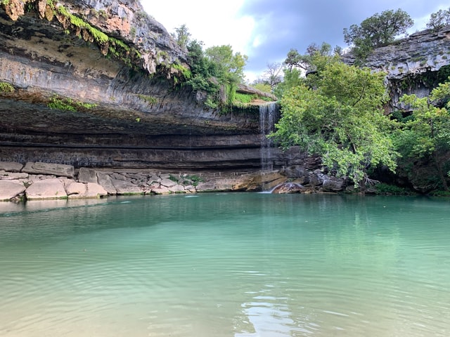
Hamilton Pool is one of the most popular natural attractions in Texas. Many tourists who come here to enjoy Hamilton's freshwater swimming pool under the waterfall.

Hamilton pool Texas

Enjoy the beauty of the pool while sitting under the waterfall. It's really fun!
The pond, which is also used as a nature reserve, is inhabited by a variety of birds and several rare plant species, including the mock-orange canyon, red bay and chatter box orchid. Is this what is called the heavenly pool?

The beauty of the Hamilton Pool is proof that there is no equal in natural beauty.
Hamilton Pool is a natural pool that was accidentally formed when the dome of an underground river collapsed due to massive erosion thousands of years ago.
Located approximately 37 km west of Austin, Texas, since the 1960s Hamilton Pool has been a favorite for tourists and locals alike during the summer.

The Hamilton Pool is managed and maintained by the government in cooperation with the private sector. Apart from being used for research, a natural pond can be used for nature studies, picnics, hiking and swimming. The swimming pool at Hamilton is guaranteed quality as it is regularly monitored.

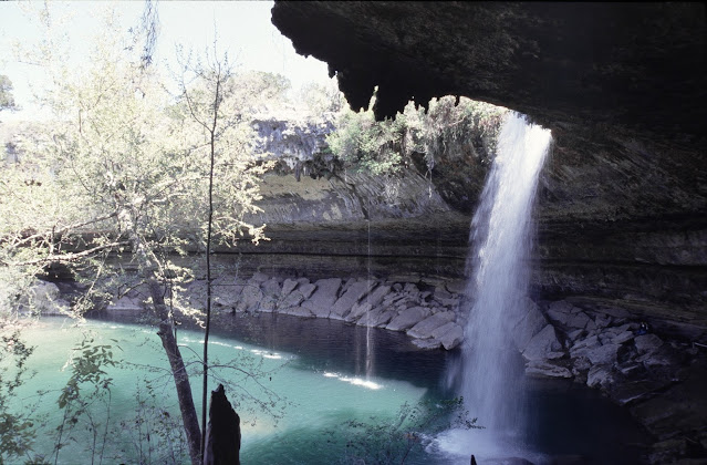
The swimming pool is surrounded by limestone slabs and large stalactites growing above the river ceiling. The beauty of Hamilton Pool is complemented by a 50 meter high waterfall that forms right above the pool.
This waterfall is never dry, but during the dry season the water drops slightly decrease. Unlike the usual days which are very heavy But uniquely, the amount of water in the pool remains constant even during the dry season period.

Hamilton pool with waterfall
                                                        Image Source: Wikimedia.org

A cave-shaped area with a 50-meter-high waterfall, surrounded by huge slabs of limestone, stalactites forming a ceiling, growing from the ceiling high above. Hamilton Pool is a natural swimming pool that was formed thousands of years ago by the collapse of a cave.
Hamilton Pools are natural pools and rivers that are not chemically treated, so water quality is monitored regularly, and sometimes the number of people swimming is also limited. Hamilton Pool is part of the Balcones Cayonlands whose surroundings are preserved and protected.

Caution is very important to care for this beautiful ecosystem. Therefore, visitors are asked to comply with the necessary rules to preserve the unique beauty for future generations.
The rules there are: no fishing, mountain biking, and no dogs or other pets allowed. Cooking and barbecue is also not allowed.

20220719

The Legend of Multnomah Falls Oregon

What is The Legend Behind Multnomah Falls?


      Waterfalls are beautiful natural scenery, and of course they can provide peace of mind and body for travelers. 
Multnomah Falls is the most visited natural attraction in the Pacific Northwest, with more than two million visitors each year to enjoy the scenery. (usda.gov)

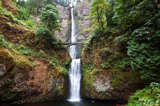
Multnomah Falls Oregon
                                               Image Source: Washington Trails Association

Multnomah Falls is located a short distance from Portland in Oregon. This waterfall is a local tourist spot where great views can be found. Many people visit this place to see the cool and clean water rushing down from the 611 feet high cliff, forming a waterfall that is mentioned in almost all the World Books and Almanacs as one of the “tallest waterfalls in the world”.
A legend is associated with its creation, telling stories of love, loyalty, trust and sacrifice. Multnomah Falls is without a doubt the best and most stunning waterfalls in Oregon.

The Legend of Multnomah Falls

Many years ago, there was an Indian village headman named Multnomah who had a beautiful daughter whom he loved very much. Due to the abandonment of her sons who died in the war, the daughter became very dear to Multnomah and she wanted to make sure that when the time came, her daughter would find the best husband.

To achieve this goal he spent time searching for the youths from the nearest village. In the end she decided that the best husband for her child would be a young village head from the Clatsop people who were a neighboring tribe. It turned out that the two of them matched and then ran a deep relationship that fell in love with each other.

Multnomah is very happy and is planning to have a big celebration for her daughter and her partner. He invited people from distant villages to celebrate his daughter's wedding, and took part in many of the activities organized. There will be singing and dancing events, and the young men will compete, against each other in archery, wrestling, swimming, canoeing, and there will also be banquets. The event was certainly huge and fun, but it's a shame that it didn't go as planned.

Terrible disease came and suffered many village members. First the children and the old people died, then the young and strong people also caught the plague. The village chief became very worried and summoned a large council of his members and sent them to the wisest and most experienced shaman in the tribe who lived as a hermit on the mountain.

The shaman seldom left his home in the mountains, but when a message came from Multnomah begging to come down to visit the village, he knew a great time had long foretold. The old shaman told the Multnomah Village Chief and the councils that what he had to say was a very grim and terrible thing, but that there was no other way to resolve the situation.

The shaman recounted a prophecy that had long been conveyed to him when he was young by his father. His father said that one day there would come a plague that would be experienced by the people. There will be no survivors of the plague except for a daughter of the village head who voluntarily sacrificed her life to the Great Spirit. This is the only way to save the villagers. The old shaman then begged to leave the council because when the prophecy had been revealed, it was time he died and he went back to the mountain.

Upon hearing the prophecy, many young girls from the tribe offered themselves to the Multnomah Village Chief to be sacrificed, including his dearest daughter. Multnomah was flabbergasted, she didn't want any of the girls to be sacrificed, and she was thinking hard about what she should do. In the end he made a decision and called a village community meeting and explained the situation. He said he wouldn't ask any of the girls to be sacrificed.

Princess Multnomah went to her father to ask permission to sacrifice herself, so that the villagers could be saved. But Multnomah refused and daughter Multnomah complied. When illness hits the man she loves, she knows what she has to do. After caring for the man she loved with affection, she quietly left the village and walked to the highest cliff.

Princess Multnomah walked to the edge of the cliff and summoned the Great Spirit to give her a sign as evidence that her sacrifice would stop the deadly plague. Then she opened her eyes and looked up at the whole sky, for a sign. She saw the sun and the clouds, then she saw the full moon rising in the afternoon. She takes this as a sign and jumps off the cliff.

The village people who contracted the disease became cured. Then the people wondered why they could recover from the plague.

Multnomah called all the girls and everyone was present except for her daughter. Then he ran down the road leading to the cliff. Peeked from the top of the cliff, and he was devastated to see the body of the daughter he loved lying lifeless among the stones below.

The villagers were sad and wept. In gratitude they built a pyramid from the pile of stones on top of his body. Multnomah called the Great Spirit to ask for a sign that her daughter had been accepted by her side. Then they heard the sound of the water and then the stream of water gushed down the cliff to form a waterfall that has been pouring down ever since.

Some say that they saw the spirit of a princess in white clothes walking up a cliff. There he stood beside the waterfall which is now called Multnomah Falls which was bestowed by the Great Spirit to show that he, who had sacrificed his life for love, was happy at the side of the Great Spirit.

20220711

Havasu Falls, Waterfalls of Grand Canyon, Arizona

The Beauty of Havasu Falls – Grand Canyon National Park


       Havasu Falls (Havasupai: Havasuw Hagjahgeevma) are scenic waterfalls on the Havasu River.
This waterfall is located in the Grand Canyon National Park, Arizona, United States, which is within the territory of the Havasupai tribe.

Havasu Falls Arizona

If you take a trip to Grand Canyon National Park, you will definitely meet Havasu Falls Waterfall.
You can reach this beautiful waterfall by walking to the small village of Supai.
After arriving at Supai Village, you can also continue by riding a horse to the waterfall, so you won't be too tired. Even so, your tiredness will be cured when you arrive at this beautiful waterfall.

Access To Reach The Waterfall Area

To get to the center of the waterfall, visitors have to walk to the post camp which is about 10 km from the ticket counter. After that, visitors still have to climb a fairly high cliff, then visitors can enjoy the beauty of Havasu waterfall

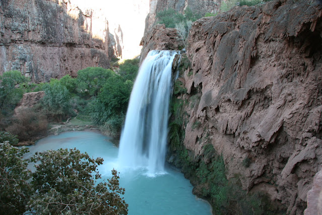
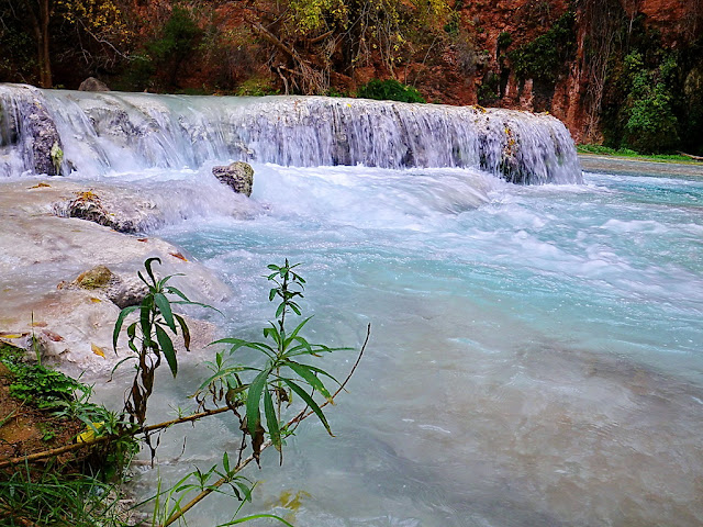
Havasu Falls which has bluish water is flanked by a barren red gorge and green trees that fall directly to the ground to form a pool.
Havasu Falls that flows in the barren land of the Grand Canyon is also considered holy water by local tribal people.

Apart from Havasu Falls, you can find four other waterfalls around this waterfall, namely Supai Falls, Navajo Falls, Mooney Falls and Beaver Falls.
However, among other waterfalls along Havasu Creek, Havasu Falls Falls is the more famous and most visited by tourists.

The bluish-green waters of the Havasu River that make up Havasu Falls fall from about 27-30 meters high from a vertical cliff into a series of plunge pools.
The high concentration of calcium carbonate in the water creates a bright blue-green color and forms the natural travertine dams that occur in many places near the falls.

The soft form and texture of the calcium carbonate content is constantly being deposited from streams throughout the lower gorge. Tufa slowly recrystallizes into travertine, the calcium carbonate structure is more durable, and ancient travertine remains have become riverbeds for the past thousands of years.
Meanwhile, modern Travertine is stored in response to water chemistry and is eroded by flooding.

Modern sites of travertine deposition occur mostly between the supai and the confluence of the Havasu and American Colorado rivers.
Due to the effects of the flash flood, the appearance of Havasu Falls and its pools has changed many times.

Havasu Falls small cascade

Before the flood of 1910, the water flowed in almost continuous sheets, and was known as the Bridal Veil Falls. The status of the watercourse first appeared in 1910, and has changed several times since.
The water currently flows as a single stream. In the past, there were sometimes multiple streams, or continuous streams to the edge. (nps.gov)

Behind the beauty of the blue Havasu waterfall, it turns out that at any time it can turn red. This was due to the presence of calcium carbonate (CaCo3) deposits and the combination of red limestone on the walls of the waterfall/canyon formed by tuff deposits.

Best Time To Visit Havasu Falls

The best time to visit Havasu Falls is in late autumn, winter or early spring. During the hot summer months, plan to hike as early as possible, to escape the heat. Bring plenty of water if you intend to hike, as no water is available, and the trail can be dry and dusty. Nevertheless, Havasu Falls is still beautiful today and is visited by many tourists.

20220707

Mendenhall Ice Caves, Natural Wonders of Alaska

Natural Wonders in Alaska, Enchantment of the Mendenhall Ice Caves


      Traveling is not just visiting popular destinations such as London, New York, Paris or Rome. On some occasions, you'll have to explore further by stopping by a row of anonymous names.
Alaska is one of the states of the United States of America. This area is filled with surprises in the form of unique and stunning landscapes. One of the tourist destinations that attracts the most attention from world tourists is the Mendenhall Ice Cave.

Mendenhall Ice Caves Alaska

The Mendenhall Ice Cave is located in the City of Juneau, Southeast Alaska, United States of America.
This cave is filled with ice on the walls which is of course the attraction.
The Mendenhall Glacier is also used as a conservation area, named Mendenhall Glacier Recreation Area. (atlasobscura.com)

Mendenhall Ice Cave is one of the amazing natural phenomena that you can find in Alaska, United States. These ice caves are part of the Mendenhall Glacier. The entire glacier covers an area of 19 km. It is in the Mendenhall Valley near the city of Juneau, southeastern Alaska. This glacier is a conservation area which is included in the Mendenhall Glacier Recreation Area and Tongass National Forest. Mendenhall Glacier is also known by the names Sitaantaagu which means 'glacier behind the city' or Aak'wtaaksit which means 'glacier behind a small lake'.

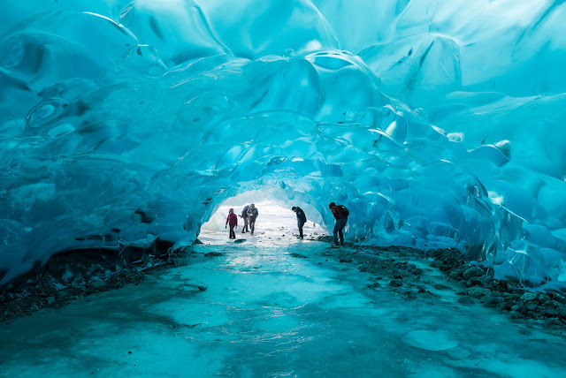
Usually, the atmosphere of the cave is dark, but it's different from this ice cave. The Mendenhall ice cave emitted a beautiful light. The glowing walls of the cave looked like blue stained glass. The rocks in it also emit a bluish color. Inside this ice cave, there is a waterfall that flows from the top of the cave ceiling. The more it adds to the beauty of the cave.

Behind the vastness of the Mendenhall Glacier is an ice cave that is very large and beautiful. It is accessible by boat. If you want to see the Mendenhall Ice Cave for yourself, you must climb the glacier hill first, because this ice cave is located under the Mendenhall glacier.

Actually, this cave is a glacier which is a large chunk of ice that formed above the ground surface and occurred in a very long time. The glacier is about 12 miles or 22 km long!

Mendenhall Ice Caves

The scenery inside is very beautiful, as if you are in another realm. Inside the cave you can witness various forms of the water cycle at the same time. You can see the beautiful water flowing above the ceiling, which looks like a tunnel of blue glass, bluish ice cubes, and a small beautiful waterfall. You'll definitely feel like you're in a marine garden aquarium.

This cave is often visited by tourists. Tourists who will see the beauty of this ice cave must first climb Mendenhall glacier. The glacier is 19 km long. When climbing, don't forget to wear warm clothes, because the temperature in this ice cave can reach 0 degrees.

Unfortunately, this ice cave is increasingly being threatened due to the effects of global warming. The increase in temperature causes the cave which is composed of this ice sheet to slowly melt.

20220628

Glass Sand Beach in California

Glass Beach California Offers The Enchantment of Colorful Glass Glitters


      There is something unique from California. If commonly the beach offers the charm of a dazzling stretch of sand, one of the US states has a beach with unique sand, made of chunks of glass. The beach is known as Glass Beach The colorful glass rocks make this beach look like gem sand. Just look at the uniqueness of this beach when visiting there. As the name suggests, Glass Beach is a beach with glass sand. Glass rocks are scattered along the coast. (californiabeaches.com)

Glass Beach California

This unique beach is located in MacKerricher National Park, near the city of Fort Bragg, California. Glass sand is formed through a process of many years. At the beginning of the 20th century, this beach became a garbage dumping area by the local people.

In the past, various wastes were thrown here, such as bottles, household appliances, and even cars! That's why this beach is called "The Dumps" by the local people. Sometimes, there are also burnings on the beach to reduce the garbage that has accumulated. After the massive earthquake that hit the San Francisco area, the streets were littered with rubble. Most of the trash and debris is thrown into the sea. Of course, from the amount of garbage thrown away there is glass waste.

In 1967, government officials and the California City Water Quality Controller began to realize that dumping garbage in the ocean was a mistake and attempted to relocate the landfill away from the ocean and coastline. 

Various programs have been implemented to clean and improve the condition of this beach. The waves that are on this beach also "clean" this beach. Carry and degrade waste. However, glass and pottery of course cannot be degraded, but only into smaller and finer forms. The small and delicate pieces of glass finally covered the surface of Glass Beach.

However, the ocean waves crashing against the beach leave glass debris in the shape of fine spheres, turning the coastline into colorful. Since then, the beach has been cleaned and beautified. As it turned out, the waves managed to turn the trash bottles and glasses there into something beautiful. Over the years, the glass waste there turns to stone. These glass rocks are no longer sharp, but are already flat and soft. Not only the shape, these rocks are also interesting because of the various colors. This natural phenomenon is what makes Glass Beach a traveler's destination.

California beach glass

Many people come to Glass Beach because they are curious about the glass sand, many also want to bring this unique sand home as a souvenir. In the past, visitors were still able to take these glass rocks freely. However, after the 150,000 square meter beach was taken over by MacKerricher National Park, the glass rocks are also protected. Even so, there are still visitors who secretly pocket one or more glass stones to take home.

If you come here, visitors are advised to use sandals with thick soles. This is to avoid the possibility of the glass stones being broken and injuring the feet of visitors.

20220609

Glacier National Park in Montana

 What to do in Glacier National Park


     Travelers to Glacier National Park will be treated to all sorts of stunning views, from jagged peaks to mirror lakes to vast blue skies. This view can be enjoyed by car, by boat (glacierguides.com), on a hike, or while sitting on the terrace in one of the historic cottages in the garden. Glacier National Park maintains a convergence of different ecosystems, varies in humidity and altitude, the landscape is diverse and ever-changing.

Glacier National Park in Montana

Glacier National Park is an American national park located in northwest Montana, on the Canadian-United States border, bordering the Canadian provinces of Alberta and British Columbia. The park covers more than 1 million hectares (4,000 km) and includes parts of two mountain ranges (a sub-range of the Rocky Mountains), more than 130 named lakes, more than 1,000 different plant species, and hundreds of animal species.

This vast pristine ecosystem is at the core of what is known as the "Crown Ecosystem Continent", a protected area of land covering 16,000 square miles (41,000 km).

Glacier National Park is part of the Water ton - Glacier International Peace Park, which was designated a World Heritage Site in 1995. The World Heritage Site designation recognizes places considered natural or cultural treasures of the entire planet.

There are so many things to see and do in Glacier National Park that you will want to visit more than once. Your first visit will definitely leave you with a memory that will last a lifetime.

While you can see a lot of great views from the road with your car, chances are you want to get out and experience nature firsthand. A hike in Glacier National Park is a great idea. The hikes range from flat, easy and ranger-led levels, to strenuous hikes.

History of Glacier National Park

The area that became Glacier National Park was first settled by Native Americans. After the arrival of European explorers, it was dominated by Blackfeet to the east and Flatheads to the west. Under duress, Blackfeet ceded the mountainous portion of their promised land in 1895 to the federal government; and then became part of the garden.

Immediately after the park was founded on May 11, 1910, a number of hotels and chalets were built by the Great Northern Railway. This historic hotel and chalet is listed as a National Historical Landmark and a total of 350 locations are on the National Register of Historic Places. In 1932, work on the Going-to-the-Sun Road was completed, which was later designated a National Historic Civil Engineering Landmark, providing easier accessibility for cars to the heart of the park.
Glacier National Park


The Mountains of Glacier National Park began to form 170 million years ago, when ancient rock was pushed upwards eastward and through much younger rock layers. Known as the Lewis Overthrust, this sedimentary rock is thought to have some of the best fossil examples of early life on Earth.

The current shape of the Lewis and Livingston mountains, as well as the position and size of the lakes, show evidence of massive glacial action, which carved a U-shaped valley and left moraines that consumed the water, creating the lake. Of the estimated 150 glaciers that existed in the park in the mid-19th century during the end of the Little Ice Age, only 25 were active in 2010. Scientists studying glaciers in the park have estimated that all active glaciers could disappear by 2030 if climate patterns currently exists.